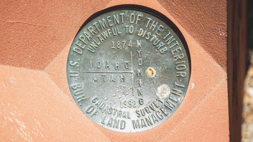
Idaho-Utah-Wyoming Tri State Marker

This Tri State Benchmark was a fun one to get to. We took Manhead Rd. North 16.4 miles of Highway 30 which is just southeast of Bear Lake, Idaho. Then we turned west on to a 2 lane track through Cristy Canyon and went 3.32 miles and then turned north on another two lane track for another .37 miles. From there we had to hike up a steep incline to reach the monument which was Read More …

Southwest Corner of Wyoming

The Southwestern corner of Wyoming survey benchmark. This is the state boundary between Wyoming and Utah. The road is drivable in any vehicle all the way to the monument. We took highway 150 south from I-80 intersection for 18.8 miles out of Evanston, Wyoming to county road 150. The we went west for 7.8 miles on county road 150 which is also called Chalk Creek Rd. The we turned south at the intersection of Chalk Read More …

Colorado-Nebraska-Wyoming Tri-State Marker

We took Beach ave. which is also County Rd. 164 south out of Pine Bluffs, Wyoming for 12.1 miles to the sign for the Tri-State Marker. From there you’ll need to walk to the actual marker. Be careful and stay on designated trail because it is private property on both sides. We were lucky enough to meet Marty that was checking on the property and livestock there and he gave us a ride in a Read More …

Geodetic Center

The replica and marker is located 160 feet east of hwy 24 and hwy 281 in Osborne, Kansas. The real Geodetic Center lies about 12 miles north of Lucas, Kansas and about 10 miles southwest of Tipton, Kansas. The Meades Ranch station is on private land, with no public access. Visited on August 23rd 2023